The strike you find, not the strike you see.
At some airports, the first evidence of a strike is a carcass found on the runway. The event, the species, and the flight involved are reconstructed afterwards, by hand.

BCMS® VENTUR · AI optical detection for airports
Birds and drones on your airfield:
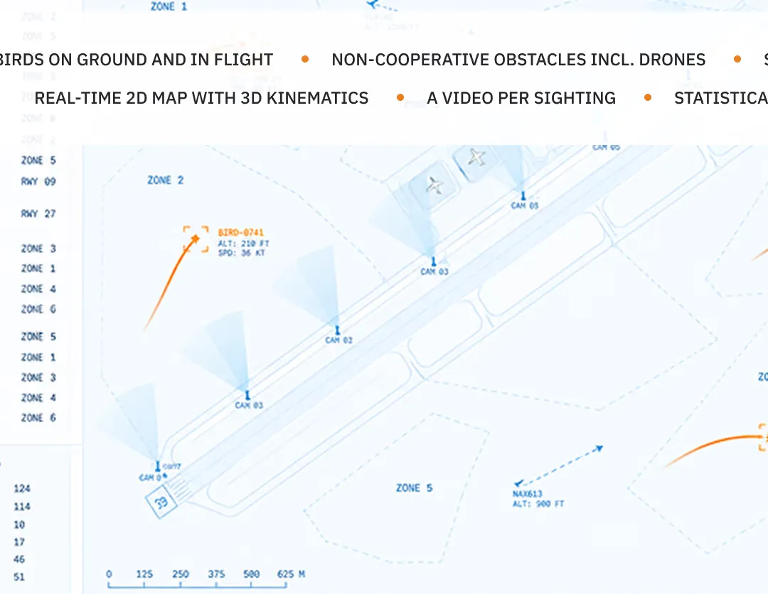
BCMS® monitors the maneuvering area and surrounding airspace with optical and thermal cameras and AI classification, day and night. Birds on the ground and in flight are detected and classified, with species classification below about 1 km, once trained on the site's footage. Drones are detected and classified. Every event is recorded on video and scored for risk, against live traffic where ADS-B is integrated. Deterrents fire under the rules your team sets.
The cameras transmit no radio signal to find a target, unlike a radar, and detection needs no spectrum license.
A radar return gives range and bearing, not identity. BCMS® classifies what it sees in real time, because ten gulls at the threshold is a decision and ten unknowns is a guess. Species classification below about 1 km, once trained on the site's footage.
Each detection is paired with a recording. What you see is what is there, and nothing is left to interpretation.
Radar generates false positives from weather, clutter, and vehicles; classification filters what the cameras see before it becomes an alert.
Runways, taxiways, aprons, and grass, where a large share of the actual risk sits and where radar capability is negligible.
No transmitter, no spectrum license, no specialist operators to interpret returns.
BCMS® runs isolated or integrated alongside radar without interference. Keeping, replacing, or combining them is your choice, not ours.
Three gaps every wildlife team recognizes, in the units they are measured in.
At some airports, the first evidence of a strike is a carcass found on the runway. The event, the species, and the flight involved are reconstructed afterwards, by hand.

One major airport measured 500 staff hours a year just locating and counting a single species. Patrol kilometers and manual logs scale with the hazard, not with the headcount.

Bird activity does not stop at dusk. Hours without thermal coverage produce no detections, no evidence, and no pattern to plan against.
Left open, these gaps surface where they cost most: in delayed movements, and in the record you cannot produce when the wildlife hazard audit asks for it.
Self-assessment
See the complete event, not just the alert.
Detection log
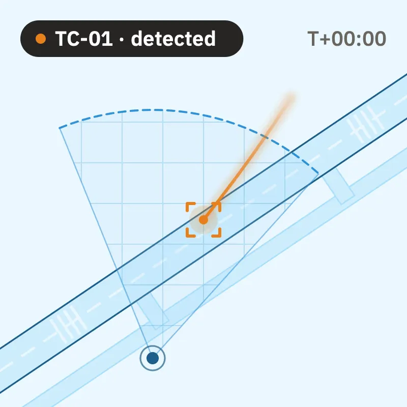
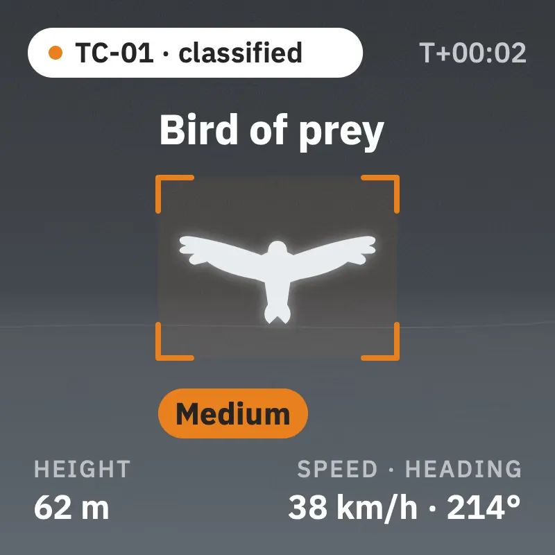
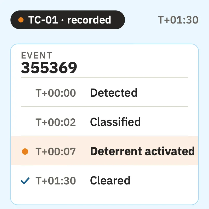
A representative event record, rendered in the console's own fields.
Detected
Single object entering the monitored volume, air track opened.
Classified
Bird of prey. Risk scored against live traffic: medium.
Tracked
Position, speed, and heading feed the risk index as the bird moves.
Deterrent activated
Runs automatically, under the rules your team sets. The activation is logged with the detection ID.
Cleared
Track left the monitored area. Video and metadata written to the archive.
Each record rolls into daily statistics and the periodic wildlife report your team files. Nothing is reconstructed by hand.
The live loop runs end to end automatically; the response follows the rules your team sets.
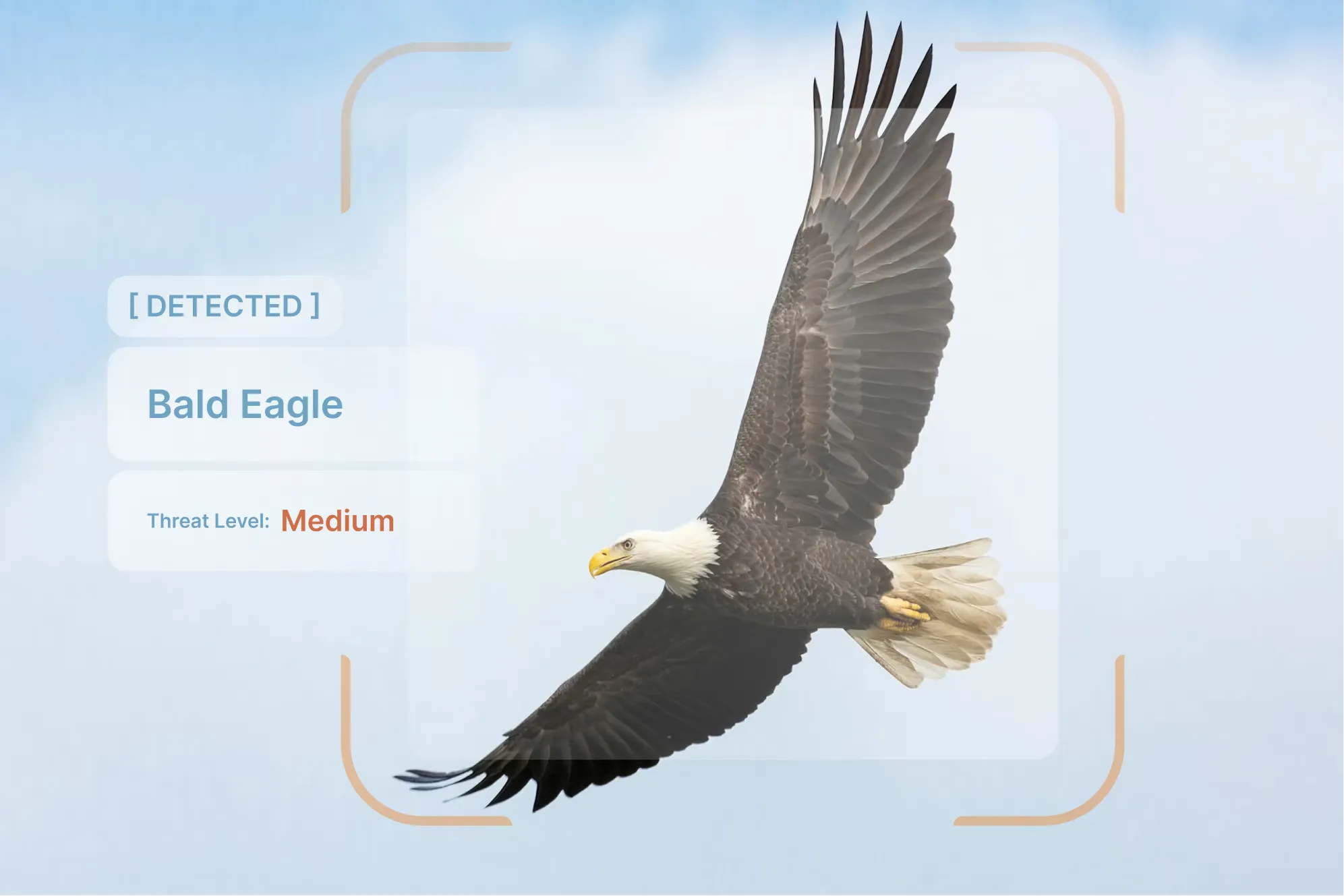
01
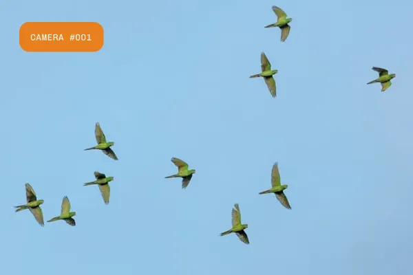
Passive optical and thermal sensors watch the maneuvering area and surrounding airspace, day and night, on the ground and in the air.

02
AI assigns species or family in real time, below about 1 km once trained on the site's footage. Each species responds to a different deterrent, so knowing which bird it is decides what happens next.
03
Position, speed, and heading feed a live risk index as the bird moves.

04
With ADS-B integration, risk steps up automatically when aircraft are taking off or landing.
05
The system drives the deterrents you already own, selectively by species and risk, under the rules your team sets, and logs every activation.
06
Every event is recorded with video and metadata, building the auditable history your reporting stands on.
One sensor set covers two problems that usually mean two procurements: operational safety against bird strikes, and physical security against drone incursions.
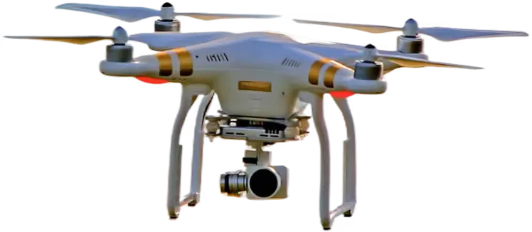
A drone entering monitored airspace is detected, classified, and tracked like any other non-cooperative object: position, trajectory, and a video record of the incursion.
Alerts raise in real time and the event feeds your existing security systems through the documented API. Detection is passive and needs no spectrum license.
The boundary
BCMS® detects and documents drones. It does not neutralize them: the response remains with your security organization, now with a track and a video instead of a phone call.
A clearer basis for technical evaluation, one row at a time.
BCMS® sits on top of the dispersal hardware you already own and makes it selective. On detection it commands activation at the exact position, matched to the species, and stands down when presence clears. Every activation is logged, and activation-versus-outcome statistics tune the deterrence profile over time.
Automated and handheld, activated by species and position.
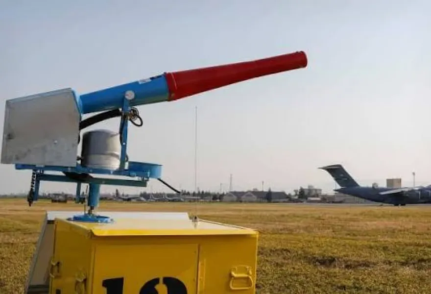
Driven over the device API, fired at the exact position.
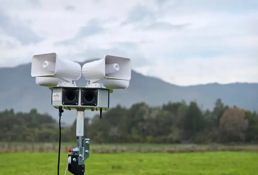
Species-specific, triggered by the classification.
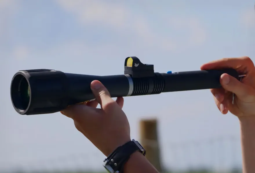
Over documented APIs, activated selectively and logged.

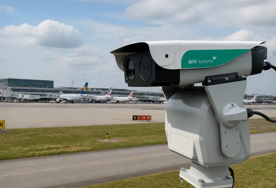
Cameras mount on poles held by above-ground concrete blocks: no excavation, no trenching. Mounting heights and positions respect frangibility rules and the open-terrain limits around runways, and THE EDGE COMPANY runs the aeronautical obstacle evaluation as part of the site survey, because sensor placement on an airfield is an operational decision, not just an installation.
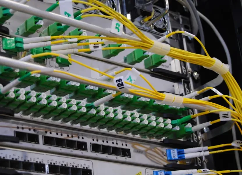
Cameras connect over fiber where available, radio links where not. A 50 Mbps connection covers remote maintenance and monitoring. Rack, power, and cooling requirements are stated before the statement of work. Compute is dedicated to BCMS®, and it can run on hardware you own: one operator runs the system on its own enterprise servers, while others take it delivered turnkey. Dedicated cameras and dedicated compute are non-negotiable; where that compute sits is your choice.
Hardware provenance is documented and answerable against US federal supply-chain rules; the IP cameras are manufactured in Portugal. Certificates run on an internal PKI. Footage is never published externally, and remote access for support is authorized by the airport per session.
Under Commission Regulation (EU) No 139/2014, the aerodrome operator decides how it manages wildlife. No European certification scheme for this equipment exists yet.
Our data protection policy is in force, and GDPR documentation is available on request; server location stated per deployment.
THE EDGE COMPANY works with EASA, under an Innovation Partnership Contract signed in 2025, on a concept of operations for BCMS® at aerodromes. A listed participant in EASA's rulemaking group on AI trustworthiness (RMT.0742). A seat, since October 2024, in EASA's expert group on safety-related aerodrome equipment (RMT.0161).
Deployment record, anonymized but specific.
Before any visit, we state which components the reference site runs against what your configuration would ship: thermal, ADS-B, automated laser, gas cannons, distress call. You compare what you would actually buy.
Speak to an operator who runs BCMS®, or put your airfield chart on the table with a technical colleague.
Reference calls and site visits are arranged with scope agreed in advance and limited to system validation. Several installations are under NDA, and live remote access to a working site is granted under NDA for the same reason. It is policy, not a lack of trust.
Grant and export-credit routes exist for smaller operators and are country-specific: ask on the call.
No obligation to continue after the trial
The system runs on your airfield against strict KPIs agreed in advance; if they are met, the decision to buy is already made, quantitatively. Then it converts to acquisition or lease, with no obligation to continue after the trial. Minimum eight months, because the KPIs must span the seasons that drive your hazard; a full pilot is twelve.
Direct purchase of the system, including direct award under a framework agreement or memorandum where one applies, the route public operators have used.
BCMS® delivered as a service rather than as equipment: THE EDGE COMPANY retains ownership of the installation, and the operator gains the financial benefits of an operating-expense structure.
The site survey is the real first step; every account that progressed converged on it.
A structured checklist covering coverage scope, your most hazardous species, charts and wildlife data, hosting, power, and network, run on THE EDGE COMPANY's collaborative survey platform. The aeronautical obstacle evaluation is part of it. Output: a report and statement of work for your approval.
Badges and escorted-access lead times start now; procurement and customs drive the calendar. Installation is typically by a local system integrator working under THE EDGE COMPANY's instructions and quality assurance.
Pole mounts on concrete blocks, no excavation.
The system produces detections from the day it is powered up and is then fine-tuned on your airfield's own avifauna. In parallel: the concept of operations and SOP workshop, operator training sized to your shift patterns, and the weekly coordination call.
The page's real reader is the colleague you forward it to. Each door is the pack for one role.

The evidence pack: night and thermal detection footage, non-avian wildlife detections, and the material for a business case.

The pilot framework: the KPI-gated try-and-buy structure, trial durations, and the reference-visit path.

The security and contracting pack: hosting options, hardware provenance, PKI and access policy, and the contract structures.
Each pack is sent on request until the files are published here.
The system continues to operate with performance that scales with visibility; degraded modes alert the operator and mark coverage gaps. Dense fog also sharply reduces bird flight activity, so reduced sensor performance coincides with reduced strike risk.
No. Detection, classification, deterrence, and recording run unattended; output is designed to be read by standard wildlife-control personnel, not specialist operators. The system removes monitoring load, it does not add a console to staff.
Yes: detected, classified, tracked, and recorded, with alerts feeding your security systems through the API. It does not neutralize them.
During the professional services contract, parts and manpower are covered; THE EDGE COMPANY holds service agreements with its hardware manufacturers and keeps dedicated spare stock, so manufacturer repair cycles do not become your downtime. After the contract, the system keeps functioning and the license stays in force, with follow-on support contracted separately.
Yes, through a documented REST API with full Swagger documentation: per-detection ID, position, altitude, risk index, size, type, speed, and heading, plus point-by-point trajectory export in JSON.
Three routes exist in operation today: try-and-buy against agreed KPIs, direct award under a framework agreement or memorandum where one applies, or delivery as a service under an operational lease. Which applies is your procurement determination; the three routes above have the detail.
Put your airfield chart on the table. Thirty minutes with a technical colleague, not a sales presentation. Bring your hazard picture; we bring the site-survey checklist.